![]()
![]()
![]()
![]()
![]()
![]()
![]()
![]()
![]()
![]()
|
|
|
|
April 1996
Sunday 21 July
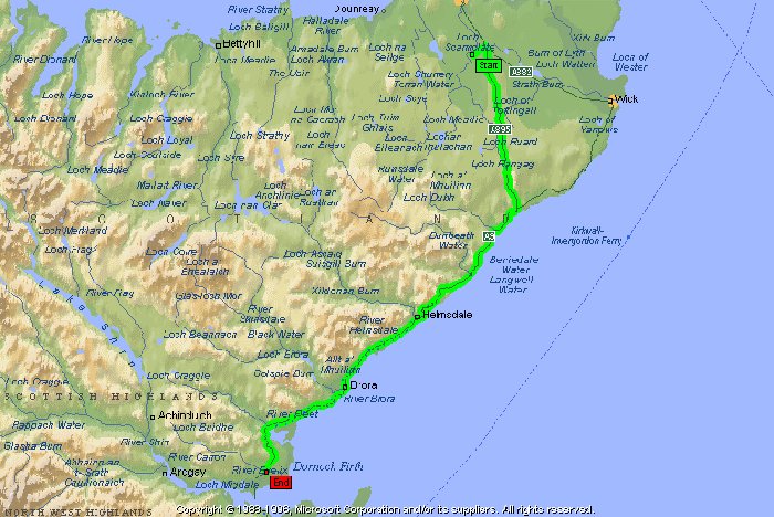
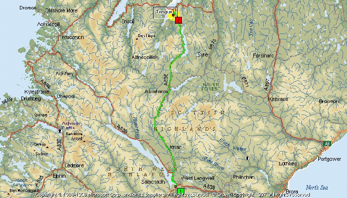
The road to Latheron was very quiet for the whole 17 miles with less than ten vehicles passing me from either direction. After Latheron, on the higher stretches of the A9, it became quite foggy and I had no lights with me. Cycle lights aren’t much use in fog anyway but I still resolved never to be without lights again. I just hoped that my reflectors and bright clothing were enough to warn other road users to avoid mutilating my body. There was nothing much to report all the way to Helmsdale. The fantastic views were obscured by fog and I could have been anywhere. I stopped in Helmsdale and bought fresh sandwiches from a shop near La Mirage and had lunch at the Tourist Information car park. I didn’t realise how cool it was until I set off again. There is a fair climb just south of Helmsdale but from there it’s an easy cycle to Loch Fleet. The road up to the Trentham Hotel is a fair climb but at least my destination was closer. Looking at the map there are quite a few minor roads into the hills that appear well worth a visit on the bike at some time. I arrived at the Trentham at 1500 after cycling 65.90 miles. This was about half a mile less than my last visit here but it wasn’t getting closer it was due to the fact that I had more air in my tyres. The accommodation was only £17 for bed and breakfast. I had dinner and a few beers and was charged a total of £34.15. Monday 22 July
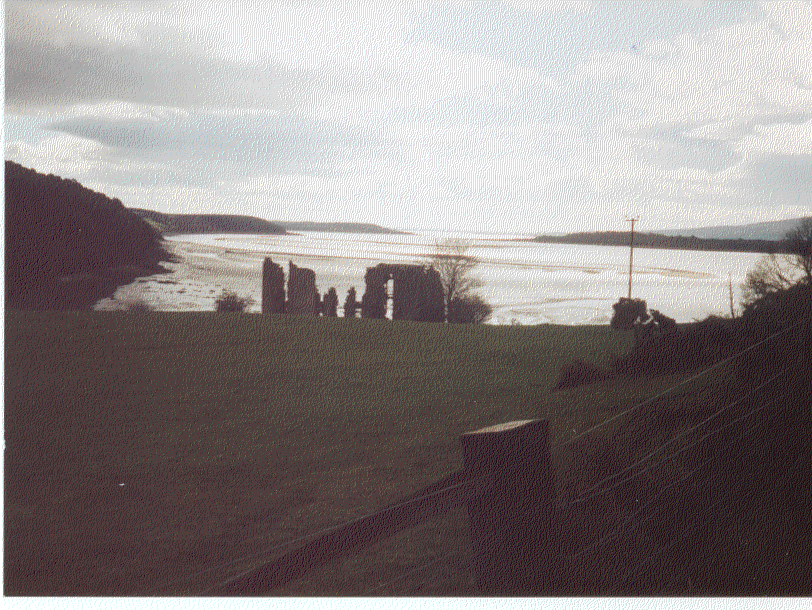
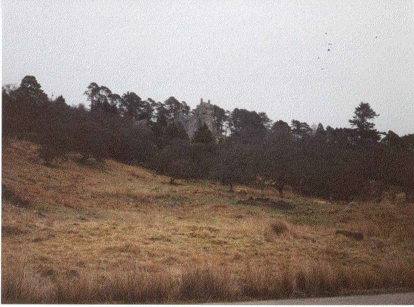
Just after Invershin Station where the railway line crosses the narrow Kyle of Sutherland I could see the impressive Carbisdale Castle.
After marrying again, Mary Blair had Carbisdale Castle built as a rival to the Duke of Sutherland’s castle at Dunrobin. Carbisdale Castle was sited in Easter Ross as close as possible to the Sutherland border overlooking the railway line so that as the Duke’s private train passed, her hated stepson couldn’t fail to see it. The castle’s clock tower has a clock face on each side except the one facing Sutherland so that the Duke’s tenants in Sutherland couldn’t benefit from it. The Salvesen family later gifted the castle to the Scottish Youth Hostels Association in 1943 to make it one of the world’s most opulent youth hostels.
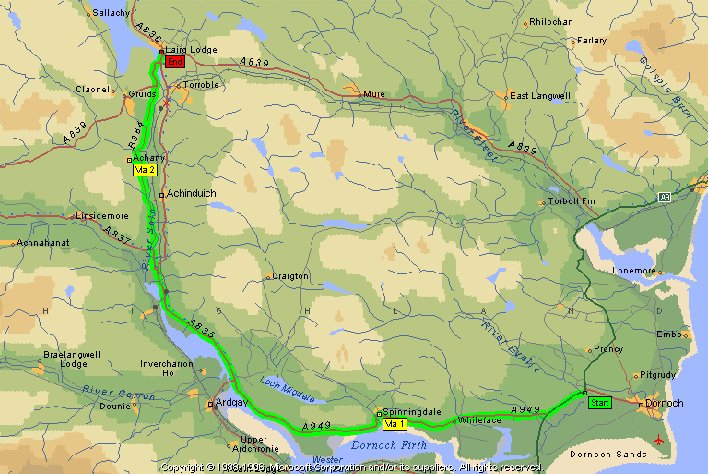
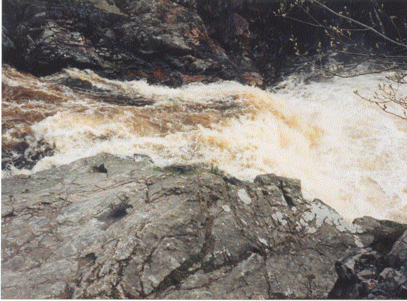
At the roadside there is a building containing a gift shop and café and other tourist amenities. Across the road there is a sign-posted footpath leading to the falls. They are quite minor as waterfalls go but they are worth a look. The road to Lairg is quite gentle and very pleasant from this side of the river. I arrived in the town at 1230 after cycling a gentle 25.89 miles. I entered the Sutherland Arms Hotel and checked in for two nights. I was told that no hot water would be available until about 1600 so after settling in I had a cold shower and then explored the town.
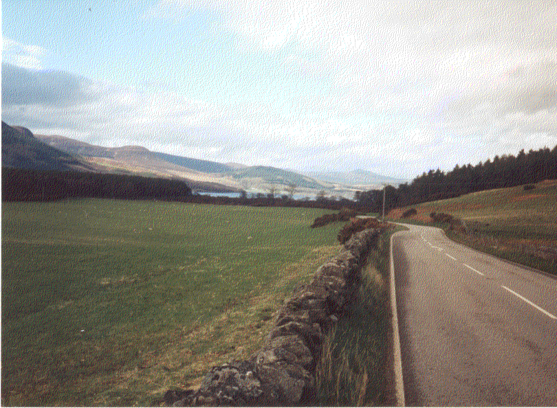
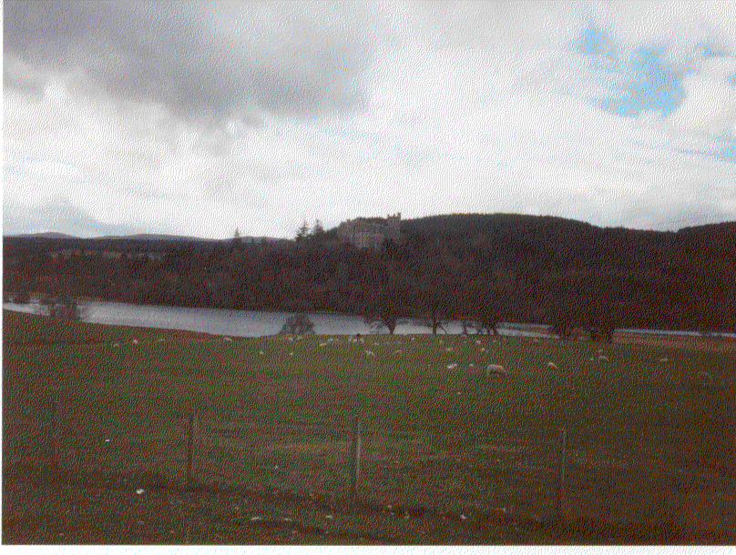
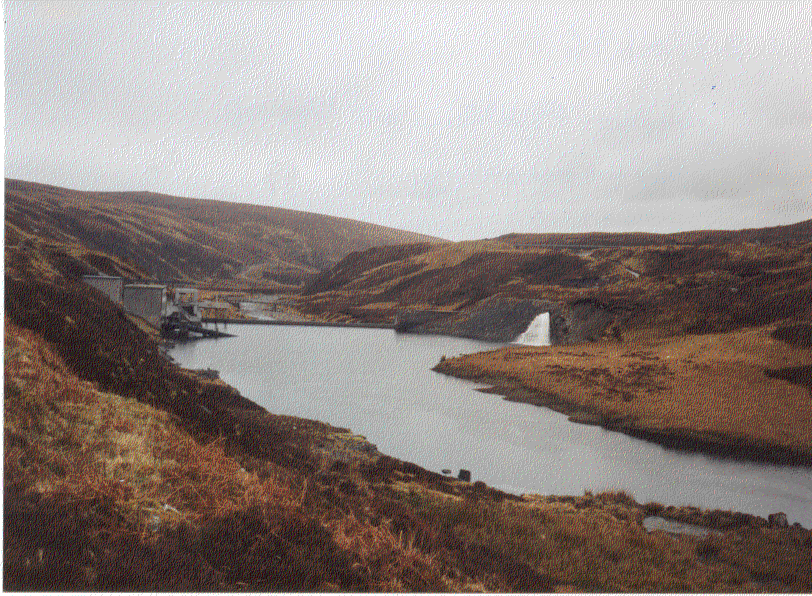
Lairg has the feel of a frontier town; a bit seedy in parts but very pleasant in others. The hotel seems excellent, apart from the lack of hot water. I was given a ground floor twin room with a fantastic view of Loch Shin. With some investment, Lairg could be an excellent tourist resort. The setting is beautiful with mountains and water, history and wildlife, and a central location. The hotel is a large shambling building with long corridors and many rooms. It is shown on the far shore of the loch in the photograph above (if you zoom in at 500% you get an idea of its extent). It’s in good order and packed with character. There are two bars, a lounge bar in the centre of the building near the dining rooms and a saloon bar. There were very few other guests but it was a Monday and still early in the season. Tuesday 23 July
After a large breakfast (and stopping off at a local shop to buy food for the trip) I set off on the A839 in good weather. It was good to ride the bike without having to carry luggage.
After nine miles, without seeing any other traffic, I arrived at Rosehall and joined the A837. At the junction there is a war memorial. At Invercassley I found the track leading up Glen Cassley without seeing another vehicle or person. It was as if I was alone in the world.
It was a gentle incline for most of the way to the end of the track at Duchally Lodge ten miles from the A837. To the north I could see patches of snow on a mountain that I identified as Ben More Assynt (3273 ft). I didn’t know it at the time but I would later climb half way up that mountain in my search for a route over to Loch Shin. I stopped for a bite to eat and a drink of water beneath the impressive looking Invercassley Castle. There was a road leading up to the castle and I could see a car parked nearby but I saw no other indication of habitation.
As the bottom of the Glen became wider the river meandered much more and I saw a number of isolated pools where the river had changed course. Further upstream the river became much faster-flowing with many rocks brought down from the higher slopes of Ben More Assynt.
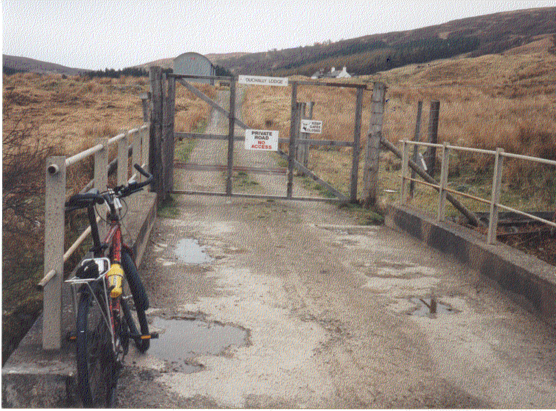
I saw a few isolated farms with clothing on the washing lines but I saw no other indication that anyone was around. After ten miles I came to Duchally Lodge and was faced with a locked gate and a sign saying "No Access". I thought about climbing over the gate until I heard dogs barking. I decided to stay put and have a bite to eat.
The map I had showed a dotted line, just over the river from where I was, that ended somewhere on the slopes of Ben More Assynt. I went back a few yards along the river and found a small wire footbridge. I crossed it easily and on the other side I found an overgrown trail following the west bank of the river. The path became quite rough, wet and steep as it climbed up the slopes of the mountain. I had put slick tyres on my mountain bike and they weren’t much use in this rough terrain. Suddenly I came to a large diameter pipeline (about five feet) crossing the trail in front of me. There was a fairly good quality track at the side of the pipe going up the hill to the west and down the hill to the east in the direction of Loch Shin. I went east and soon cycled down to a small loch where the pipe terminated.
The road climbed steeply over the hills to the east of Glen Cassley reaching a height of over 1500 feet then dropped down to Loch Shin. After the road crossed the narrow northern extremity of Loch Shin I came across a vehicle barrier. There was room for me to pass so I continued on to the single track A838. At the junction, near Corriekinloch, there were three or four houses and I came across the first person I had seen since leaving Lairg. We waved to each other but I continued on towards Lairg. I was now heading south and to the west all the way to Lairg (19 miles to the south) I could see the hills that formed the eastern flank of Glen Cassley. I stopped for a bite to eat at the lochside. I had a sandwich and a pear that I had bought in Lairg. It’s amazing that as I write this nearly four years after the event, I can still remember what I had to eat on Tuesday 23 April 1996. It started to rain and it became very heavy as I proceeded south. There was little traffic and the road was an easy cycle but it was very wet and cold. I arrived back at the hotel after cycling 52.52 miles. Although it was only 1520 hours there was plenty of hot water and I had a great shower. After a good dinner I chatted to another guest who was walking from Dunnet Head (the northern-most point of mainland Britain) to Lizard Point (the southern-most point). He was a retired soldier who had led a very active life. His wife had recently died and he was looking for a challenge to keep him occupied. He told me that he left Dunnet Head last week and stayed at The Commercial in Halkirk where he was put up free of charge. In the next three or four days he walked to Loch Choire Lodge where the gamekeeper put him up for the night. On this day he had walked about 21 miles to Lairg in poor weather. He didn’t have a map for the next stage of his walk so I gave him one of mine. About six months later it was returned to me in the mail saying "John, many thanks for your kind loan, Joe Durey". I wonder if he still plays tennis. The lady who served us dinner and drinks in the evening kindly dried my tracksuit top. I went to bed feeling relaxed after more than a few beers and malt whiskies. I noted that Lairg didn’t have a cash machine. Wednesday 24
The road climbed to 872 feet close to a hill called The Crask and the views were fantastic. In all directions I could see apparently endless miles of hills and forests with occasional rivers and lakes. The weather became worse with showers and a strengthening wind but it was gently downhill to Altnaharra with the bulk of Ben Klibreck (3157 feet) dominating the view to the east. As I cycled through Altnaharra I noticed the weather station, that often features in the news for the lowest temperature in Britain. I also came across a woman of around 170 strolling across the road; I had to swerve to avoid her. It was a good job I wasn’t driving a car. I had lunch in warm sunshine at the junction with the B873 road that follows the shore of Loch Naver to Syre. It was only 17 miles to Tongue but the weather looked threatening.
Ben Loyal sheltered the road following the lochside and I had a great cycle for the seven miles along the shoreline.
J ust after leaving Loch Loyal the road climbed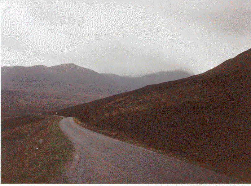 steeply
and the rain became very heavy all the way to Tongue. The climb seemed endless
but I eventually reached the top and started to descend. I was now soaked but at
least the last two miles were steeply downhill to the picturesque village of
Tongue. steeply
and the rain became very heavy all the way to Tongue. The climb seemed endless
but I eventually reached the top and started to descend. I was now soaked but at
least the last two miles were steeply downhill to the picturesque village of
Tongue.
I arrived at the Tongue Hotel at 1400 hours after cycling a fairly easy 39.63 miles (in spite of the weather). There was only one single room available at the hotel at the special price of £25 per night (when I stopped here the previous August it was £28). Thursday 25
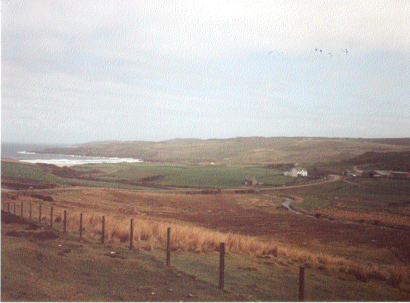
It was a fairly easy cycle to Coldbackie beneath the distinct Cnoc an Fhreiceadain (1007 feet). I noted that the name of this hill is similar to the hill overlooking Dounreay, Cnoc Freiceadain, and the one close to Halkirk, Beinn Freiceadain next to Ben Dorrery. The beach below Coldbackie is my favourite in Britain. It has everything that I like. If it were on the south coast it would be packed with amusement arcades and a lift down from the roadside to the beach.
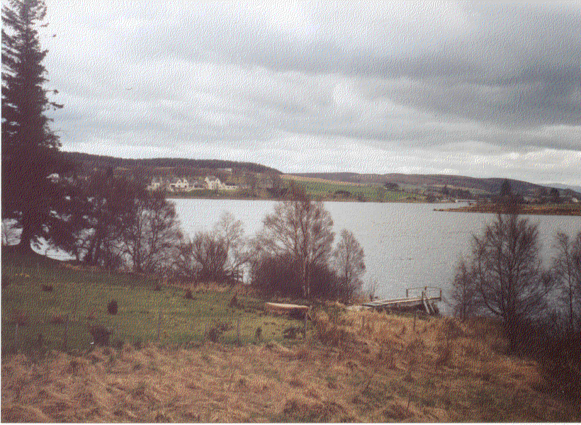
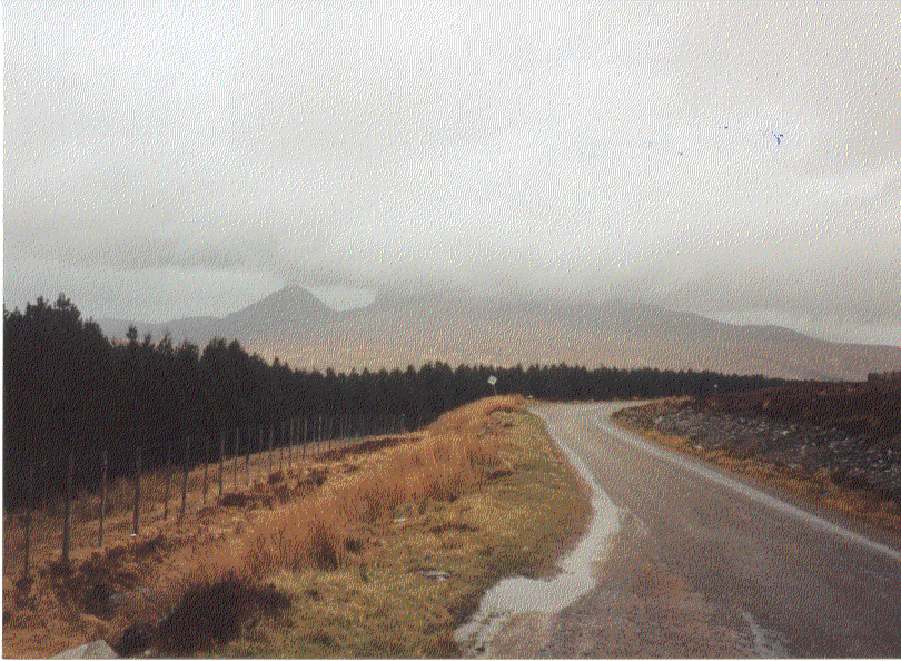
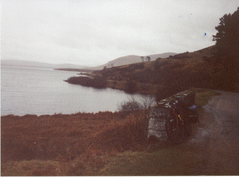
There were substantial roadworks between Armadale and Melvich. The single-track road was being upgraded. When I arrived at Melvich I decided to stop at the Melvich Hotel and have tea and sandwiches. The fire was blazing in the lounge bar and I was reluctant to leave but when I did I found that the wind had changed direction and it was now behind me. The last hill of the journey from Melvich was easy with the tail wind. At the lay-by overlooking Reay I took this photograph. My colleagues at Dounreay were all hard at work while I was enjoying myself. At Isauld I took the Shebster road and had a relatively easy cycle all the way to Halkirk. At Shebster I took the back road passed Broubster and Calder and the only traffic I saw was in the form of sheep.
The cloud became thicker and it started to rain as I approached Halkirk. One thing I noticed on the journey was the lack of evidence of spring growth, yet when I arrived in Halkirk, many of the gardens had colourful displays. I arrived in Halkirk after cycling 49.86 miles on the day and 233.8 miles for the trip. | |||||||||||||||||||||||||||||||
|
|